Maps of the 1893 World’s Columbian Exposition fairgrounds offer a fascinating look at the evolving design of the Jackson Park campus and of the continuous changes during the run of the Fair. The Library of Congress holds many interesting specimens of World’s Fair cartography in the collection of the Geography and Map Division. Cynthia Smith’s blog post “Chicago in 1893: Selected Maps of the World’s Columbian Exposition” (December 4, 2024) highlights several maps and exhibit hall floorplans from the Chicago fairgrounds.
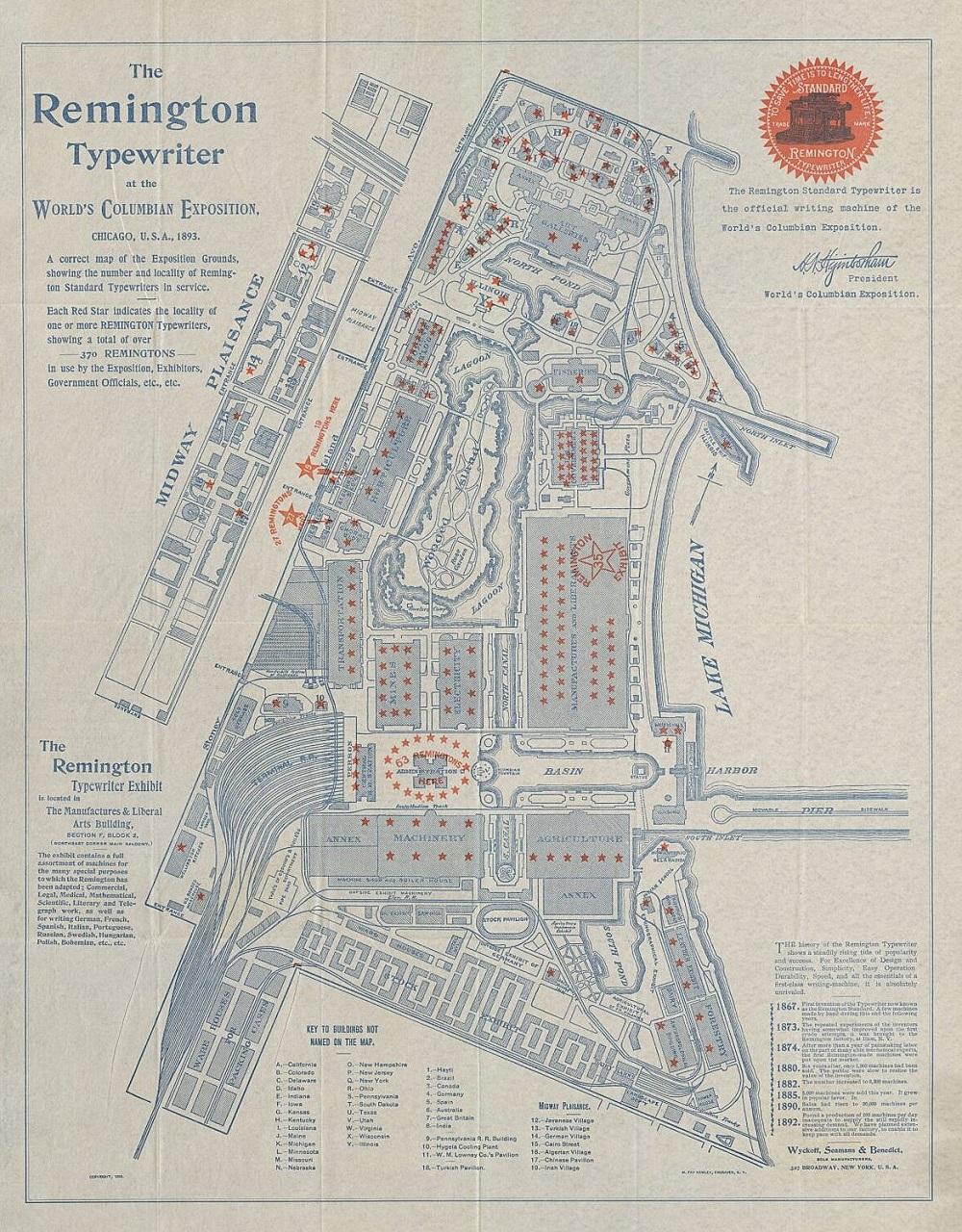
The Remington Standard Typewriter was the official writing machine of the 1893 World’s Columbian Exposition. The Wyckoff, Seamans & Benedict company had a display in northeast corner of the main balcony of the Manufactures and Liberal Arts Building and also provided this maps showing the location of their Remington product on the fairgrounds for anyone wanting to see more examples of the time-saving machines in action. [Image from the Library of Congress.]





Leave A Comment