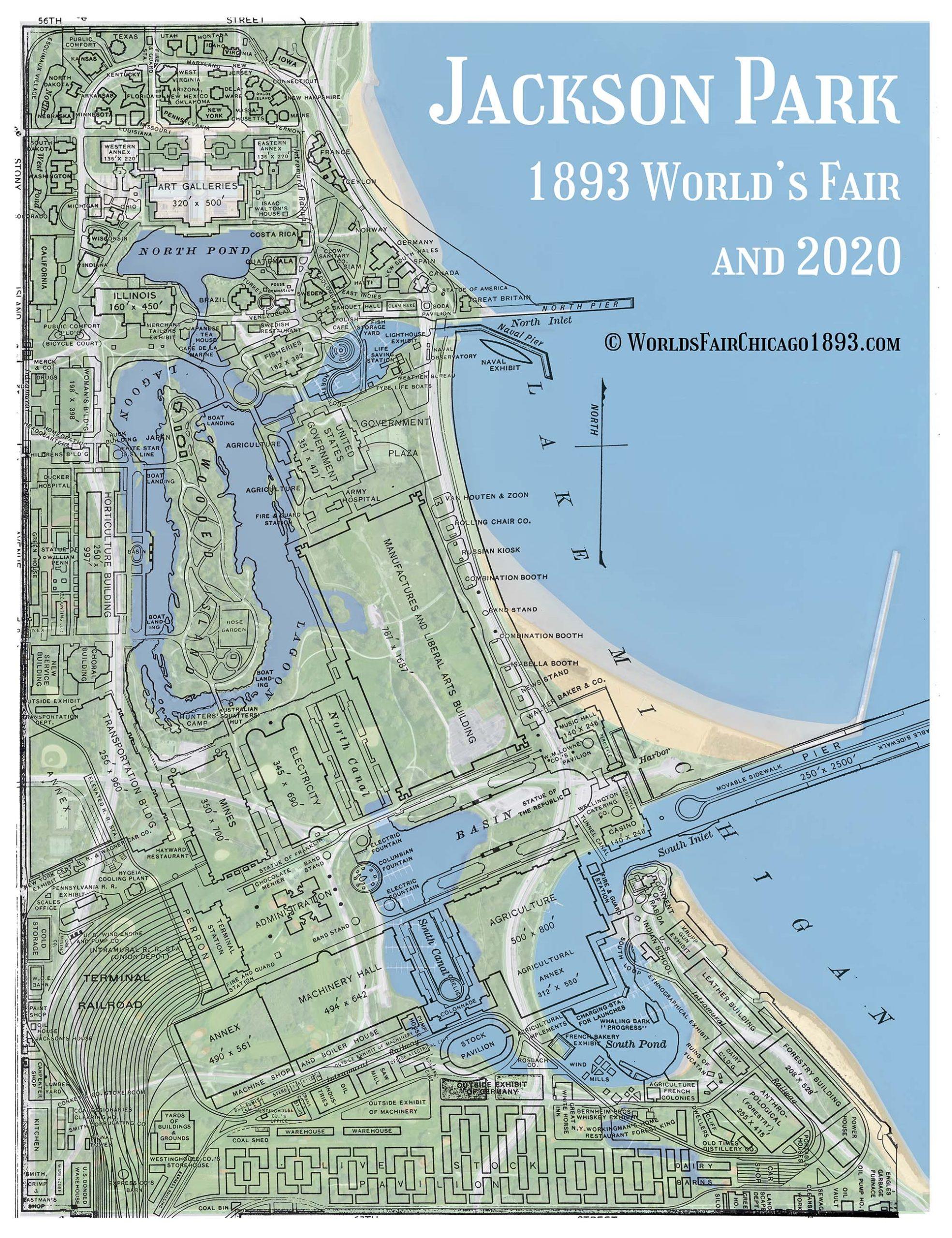
The 1893 World’s Columbian Exposition occupied 686 acres on Chicago’s South Side. The main fairgrounds in Jackson Park occupied the area bounded by 56th Street on the north to 67th Street on the south and from Lake Michigan on the east to Stony Island Avenue on the West, and included the “White City” of great palaces along the Grand Basin. The Midway Plaisance stretched west from Stony Island Avenue to Cottage Grove Avenue, between 59th Street and 60th Street. The fairgrounds contained hundreds of buildings, fifty-seven miles of roadway, and three miles of intertwining waterways.
Explore the buildings in each of these categories:
A. The Great Exhibit Halls
B. The State Buildings
C. The Foreign Buildings
D. Public Services (restaurants, comfort stations, medical services, music halls, etc.)
E. Other Exhibits
F. The Midway Plaisance
G. Sculptures
H. World’s Columbian Exposition utility buildings
Interested in exploring Jackson Park today? This map overlays the 1893 fairgrounds from A History of the World’s Columbian Exposition by Rossiter Johnson (D. Appleton and Co., 1897) with a 2020 Google maps image. [Image © worldsfairchicago1893.com]