
At the 1893 World’s Fair, the Commonwealth of Massachusetts displayed “an ingenious map prepared for the World’s Columbian Exposition at Chicago, showing at a glance which of the towns in the state have free public libraries and the number of volumes in each library at the beginning of 1893,” according to the March 1894 issue of The Library Journal.
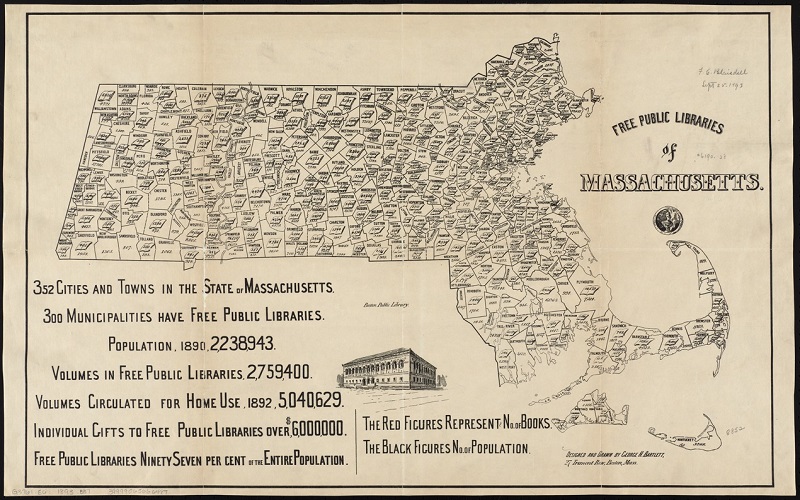
The “Free public libraries of Massachusetts” map by George H. Bartlett was on display at the 1893 World’s Fair., [Image from the Digital Commonwealth Massachusetts Collections Online.]
Bartlett’s original 44-by-68 cm. map is in the collection of the Norman B. Leventhal Map Center at the Boston Public Library. A reduced copy of the map was reproduced in The Massachusetts Free Public Library Commission’s Fourth Report (1893).
SOURCES
1893 – MBLC Celebrates 125 Years http://guides.mblc.state.ma.us/mblc-125-years/1893
Johnson, Rossiter A History of the World’s Columbian Exposition Volume 2 – Departments. D. Appleton and Co., 1897.
The Library Journal March 1894, p. 102.

Leave A Comment